INTRODUCTION
The River Bulbourne is one of our several chalk stream rivers, which are fed by groundwater stored in the chalk aquifer, and flow SE from the Chiltern hills, which stretch from Bedfordshire at the N. Eastern end to Oxfordshire and the River Thames at the S.Western end.
The fully flowing Bulbourne is about 7 miles in length, and downstream it finally joins with the River Gade at Two Waters, Hemel Hempstead.
Along its course, it has suffered many diversions over time, including being culverted in places entering Berkhamsted, and then ignominiously being forced to weave in and out of the canal, both in, and downstream from, Berkhamsted.
The river’s headwaters, and even down to Northchurch, are known as a winterbourne river, whereby it is expected to dry out at some period during the summer.
THE UPPER BULBOURNE REACHES
The headwaters of the river have suffered even more dramatically over the last 200 or more years.
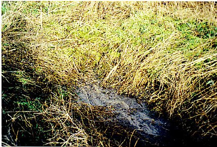
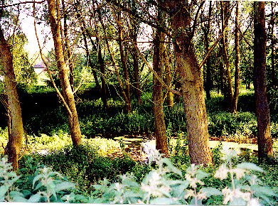
The present source of the river is at Dudswell, on the South side of the canal, about 300 metres downstream from Cowroast, where there is a pumping station and lock.

Photographer Jean de Selincourt.

Photographer David Simmons.
However, there is clear evidence that this source has migrated downstream from higher reaches overtime. In 1700 the source was quoted to be at Parkhill Farm, near Pendley, being 2 ½ miles above it’s present source. What are the reasons for these changes?
In the later half of the 18th Century came the excavation of the Grand Junction Canal, which opened in 1799. Canal systems require a lot of water to function. Cowroast lock is the beginning of what is known as the Tring summit, which stretches on for 3 miles, all being the highest level of the canal here. From either end, in use, the locks empty downhill, and every time a lock is opened about 50,000 gallons of water is lost. The 4 Tring reservoirs were constructed in the early half of the 19th Century to supply this need. And the Bulbourne head springs, then via a pond, already flowed into the summit.
But still more water was needed, resulting in boreholes at Cowroast, first in 1848, and later at Northchurch, first used in 1942, all for pumping water directly from the aquifer. There is a mountain of evidence to show that these pumps have had, and still have, great implications for the health of the Bulbourne.
Also, at Newground, 1 mile NW of Cowroast, a borehole was sunk in the late 1800’s, which for many years has been supplementing the Aylesbury Vale’s public water supply; again more depletion of the Bulbourne’s local aquifer. However of recent years, changes have been made to decrease the amount of daily pumping, with provision of an alternative source to supply the Vale, and pumping at Cowroast was due to finally cease recently, during December 2009.
REPORT REFERRING TO RIVER BULBOURNE’S UPPER REACHES, FROM OCT,’06
By the end of October ‘06, following several dry summers, the water table depth lay at approx. 4¾ metre down below the river bed, which was the lowest depth reached since 9 years (Oct.’97). Fortunately we were now getting a wet winter and there was a rapid rise in the ground water to reach the river bed at Dudswell by late January ‘07 and by March ‘07 was flowing from the ‘head’. This was the first time to see the upper reaches flow for 4 years; the river finally dried in Dudswell at the end of August, which was unusually late in time. The thirsty aquifer had been filled.
By November ‘07, the water table reached its lowest at a mere ¾ metre down, and by 12th January ’08 the river was flowing from it’s ‘head’. The public water supply was guaranteed, no restrictions, for the year. And again the river dried at Dudswell, unusually late, at the end of August.
By November ’08, the water table was at its lowest just 1/3 metre down. And in ’09 flow from the ‘head’ and in Dudswell ceased at the end of May; this was much earlier than in the last two years.
By November ’09 the lowest autumn borehole reading was recorded at almost 2 metres, considerably deeper than at the same time last year, and as routinely soon began to rise again. The most recent reading, taken on 17th January showed the water table to be just 1/10th metre down; on 22nd January we had a day of rain, and since then the ‘ditch’ bed holds standing water, for a stretch, but there is still no flow. Let’s hope we have some useful February rain.
